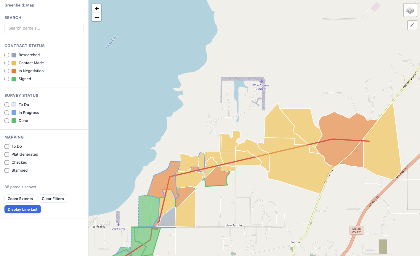
Right of Way Management Software
Track every parcel, contract, and payment across your pipeline project in one place. Lookout gives your land team live visibility into acquisition progress so nothing falls through the cracks.
Import parcels from GeoJSON, KML, shapefiles, or CSV and see them instantly on an interactive map. Your team works from the same live view — no spreadsheets, no version confusion.
Bring in GeoJSON, KML, KMZ, shapefiles, and CSV. Lookout auto-detects your column mappings so you can start working immediately.
See every parcel in geographic context with status-coded layers. Identify gaps and prioritize outreach at a glance.
Find parcels by asking plain questions — "show me unsigned parcels in county X" — powered by intelligent query processing.
Define multi-step acquisition workflows for each project and track every parcel's progress through them. Your team always knows what's next — no status meetings required.
Build workflows that reflect your actual process — from initial contact through survey, negotiation, and closeout.
Move multiple parcels through workflow steps at once. Process changes across your project in seconds, not hours.
See exactly where every parcel stands. Project dashboards update instantly as your team advances parcels through each stage.
Attach contracts, survey records, and permits directly to each parcel. Track every payment and generate reports without digging through shared drives or reconciling spreadsheets.
Every file lives in context — upload, categorize, and retrieve contracts and surveys tied directly to the parcel they belong to.
Record and manage payments per parcel with full audit visibility. Know exactly what's been paid, what's pending, and what's outstanding.
Every change is logged with timestamps and user attribution. When compliance questions arise, the answers are already there.
Manage projects with role-based access so owners, managers, surveyors, and viewers each see exactly what they need. Coordinate across the office and the field without the back-and-forth.
Assign team members as owners, managers, surveyors, or viewers. Everyone gets the right level of access and control.
Run multiple pipeline projects simultaneously, each with its own team, workflows, and parcel data — all from one login.
See who changed what and when. A live activity feed keeps your team aligned without constant check-ins.
Passage Integration
Already using Passage to manage your pipeline project? Lookout syncs parcel data directly into Passage so your land team and project managers stay on the same page — no double entry, no data gaps.
See how Lookout can replace the spreadsheets, shared drives, and disconnected tools your land team relies on today.
Schedule a live demo with our team.
Arrange a right of way workflow consultation.
Manage your land acquisition with confidence.